Toolkit
The ACTION pilots

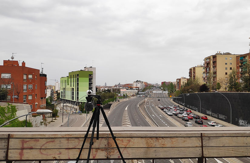
AZOTEA
Azotea measures light pollution through photographs of the night sky. The brightness of the night sky and its color depend on the amount, type and location of light pollution sources, such as traffic, shops and offices. A decrease in human activity is normally associated with darker skies. AZOTEA monitors the brightness and color of the night sky using DSLR cameras on participants’ roofs, to evaluate variations in light pollution during the global pandemic.
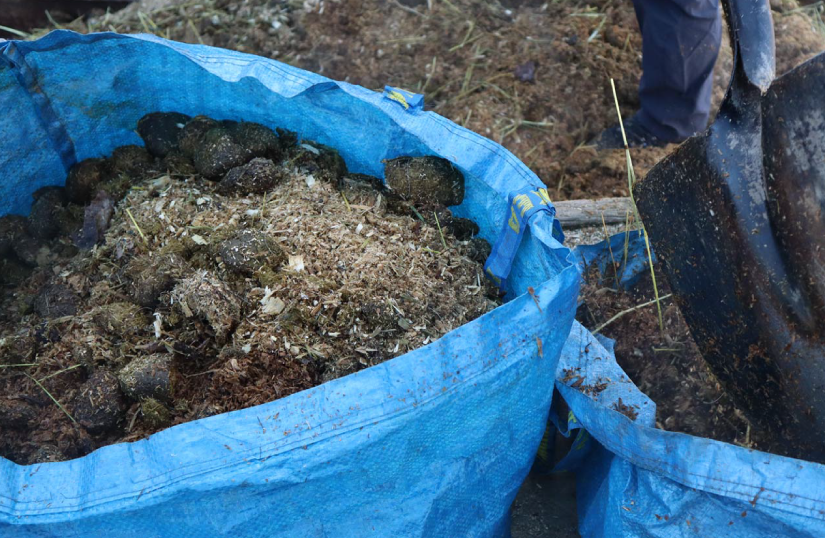
Citicomplastic
Citicomplastic co-created solutions for bioplastic waste management with vulnerable groups and other community members in Oslo (Norway). It set up a physical composting station for experiments, to raise awareness about bioplastic waste and how to handle it, demystify the science of composting, and narrow the distance between people and their trash.
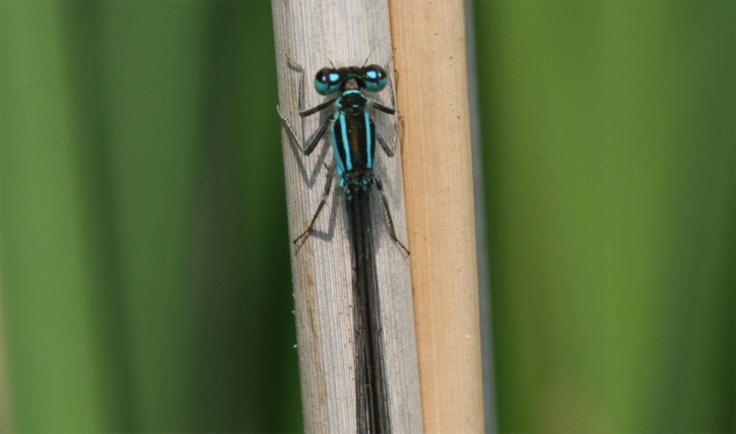
Dragonflies and pesticides
This project is concerned with the effect of pesticides on dragonfly populations. Water quality has improved quite a lot in the second half of the last century and dragonflies, as aquatic insects, have recovered in this period. However recently numbers have started to decline again. Organiser De Vlinderstichting knows this because hundreds of their volunteers count dragonflies every two weeks on fixed transects. By comparing the number of dragonflies that are counted they can see how different species are doing in different locations, and even some of the least critical species seem to be disappearing from certain parts of the Netherlands.
Even at levels regularly found in ditches, a specific insecticide can have strong negative effects on damselflies. In this project, participants take water samples, and pesticide concentrations are measured in a central laboratory. This allows the project to investigate whether the trends in dragonflies reflect the exposure to pesticides, the extent pesticides are a threat to dragonflies, and which pesticides are most harmful.
In my backyard
This project aimed to understand, map, and ultimately reduce the use of pesticides and fertilisers, and encourage sustainable alternative practices in the context of home farming and gardening. Based in the Neiva river mouth area, in the municipality of Esposende, Portugal, it worked with a community of home farmers and gardeners. The project generated open data on pesticide and fertiliser usage in home production (farming and gardening) and sustainable practices for home farming and gardening.
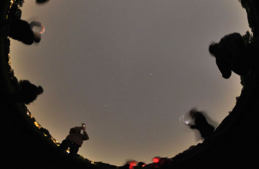
Loss of the Night
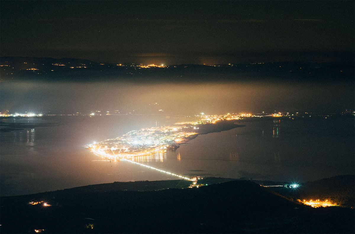
This project invites citizen scientists worldwide to measure light pollution by using the human visual system as a light meter. Participants look for specific stars, and report if they can see them from their location through the Loss of the Night App. Measurements can be made wherever the sky is observable, for example in parks or in open spaces. Observations are sent anonymously to the Globe at Night project to be archived.
The illumination of the night sky increases annually, outshining the stars, indicating energy waste, and disturbing sensitive nocturnal species. Scientists are concerned that light pollution might have a big impact on nocturnal ecosystems, but they have very little information on how skyglow is changing, especially considering the recent transition to LED lighting. This cannot be achieved with current satellites, and in general is difficult to do via remote sensing, because satellites look at the ground, not towards the sky.
Mapping Mobility
This is an online project, which teaches citizens how to collect spatially referenced mobility data about their travel patterns within their local community. Participants will use the data they collect to encourage and educate their community and local authorities about sustainable travel opportunities and barriers for the town, thus tackling issues of local transport-related pollution.
Noise Maps
This project allows citizens to generate and analyse urban sound data, empowering communities to take action to reduce unwanted noise and protect the local sonic heritage. The pilot builds on existing cultural practices of collective documentation of the sound heritage of neighbourhoods (Mapa Sonor). Thanks to project activities citizens will be able to filter unwanted noise out from authentic, locally unique sounds, thus allowing communities to take action to preserve their sonic heritage. NOISE MAPS deploys a combination of tested tech and methods with a novel approach, to empower communities to leverage the power of citizen science to tackle local challenges of global relevance.
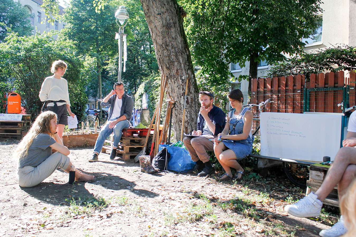
Open Soil Atlas
This project is developing an open-source co-learning centre for a local community in Berlin. The centre will consist of a website presenting guidelines in a textual and infographic form to educate the public and raise awareness about soil quality and fertility, and the correlation between healthy soil and healthy communities. Participants learn how to make observations, test soil, interpret results and draw conclusions. Soil quality data and GPS locations are collected and will contribute to a high-resolution soil quality map. The process will then be replicated and expanded, in order to engage different communities and spread the analysis to new and different sites all over the world.
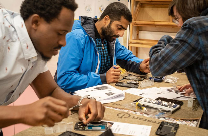
Restart data workbench
This is an online project which addresses the global dimensions of pollution and consumerism, and the impacts of the take-make-throw economy. It explores together with the repair community what impact repairs of electronic devices have on the environment, especially our carbon footprint. The project will engage the wider public by creating online microtasks to analyse data about attempted repairs, investigating the environmental impacts of the products repaired and using our results to influence policy discussions.
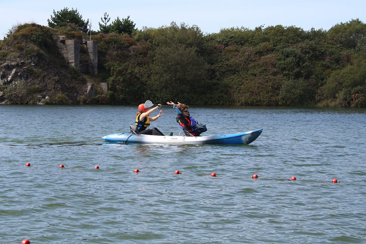
Sonic Kayaks
This project has been developing low cost open hardware for gathering and mapping fine-scale marine environmental data, which has not been previously possible to obtain. Data is sonified through an onboard speaker allowing paddlers to seek out areas of interest and gain real time feedback of the data. The existing system includes underwater temperature sensors and a hydrophone for measuring underwater sound, each recording data every second with GPS, time and date. Working with ACTION, two new environmental sensors (turbidity and air quality) were designed and integrated.
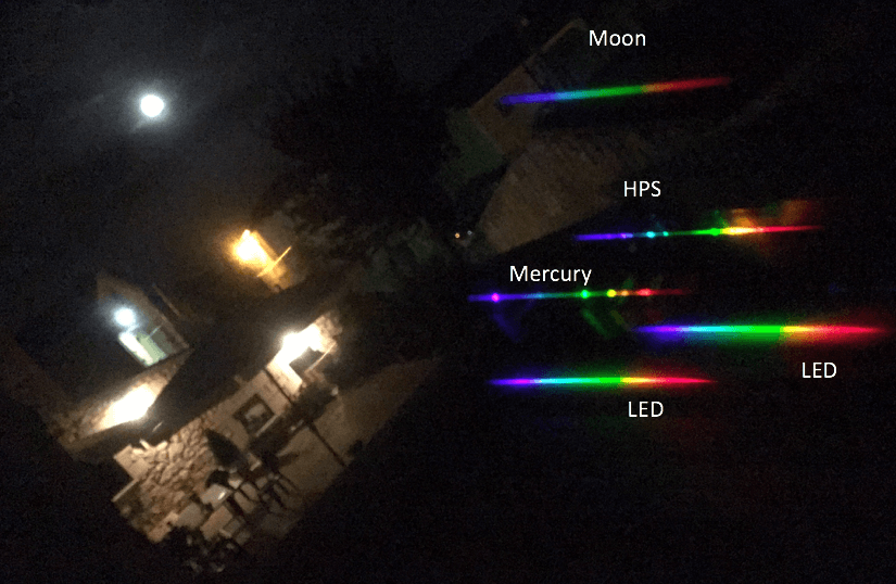
Street Spectra
This project is mapping and characterising public lighting. Volunteers use a low cost diffraction grating on top of their smartphones’ camera to take pictures of street lamps and their emission spectra. The resulting images allow classification of the street lamps by comparison with example pictures of well known lighting systems.
The creation of the project was motivated by the global switch to LED street lighting. The project creates a public database which is considered the primary output, and will allow scientists to study the effects of this change of technology on light pollution. Street Spectra is currently using epicollect5 to gather data, but an ad hoc mobile application is being developed to improve the participants’ experience.
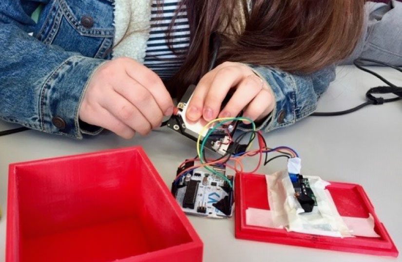
Students, air pollution and DIY sensing
This is an educational project based in Norway, engaging high school students with the design and execution of their own air quality projects, using an off-the-shelf air quality sensor. The aim is to create awareness of sources of air pollution, make students think of ways to reduce emission and exposure, and teach them scientific methods.
The project offers a workshop for teachers where they get information about air quality and air pollution sources, measurements and (health) effects, as well as an opportunity to build a sensor themselves and learn how to program it, enabling them to teach it to their students. The students learn about air quality/air pollution and its effects on society, build their sensor packages and program them, carry out their own measurements, and interpret the results. At the end, all students are invited to join a student conference where they present their work on a scientific poster.
Tatort Streetlight
This project is engaging citizen scientists in the protection of the insect fauna from light pollution. Street lighting can greatly affect nocturnal insects by attracting them to the light and depriving them of their habitats. In addition, if the attraction radii of adjacent street lights overlap, this can result in a barrier effect, making it much more difficult for insects to pass an illuminated street. For this reason, a new street lighting design will be developed to minimise the radiation of light onto the insect habitat. The geometry of the light is strictly directed downwards, so that the light only illuminates the sidewalks or streets and objects on it. The new street lighting will be installed in four communities in Germany. Tatort Streetlight observes the occurrence and behaviour of insects for two years before and after the conversion from the existing street light to the new design.
The project will collect insects from traps placed at street lights, and invite amateur entomologists to sample and identify insects, to discuss the results, and to develop ideas for sustainable solutions for night time illumination. For school classes, it will provide opportunities to work with insects, learn about the importance of insect diversity for many ecosystems, and learn about technological equipment to measure the impact of night time illumination.
Walk Up Aniene
This project is based in the Aniene Valley Nature Reserve’s in Rome’s North East periphery. It engages visitors of the reserve with individual observation and data gathering activities using their phones, to collect key data about the area, map environmental criticalities, and support responsible institutions to plan environmental restoration. The project analyses the environmental quality of the river riparial area while enhancing participation at local level. Monitoring activities will provide data to develop a report on the Nature Reserve of the Aniene Valley and a GIS map that will highlight areas of main criticalities to be addressed, restoration needs and valuable areas to be protected.
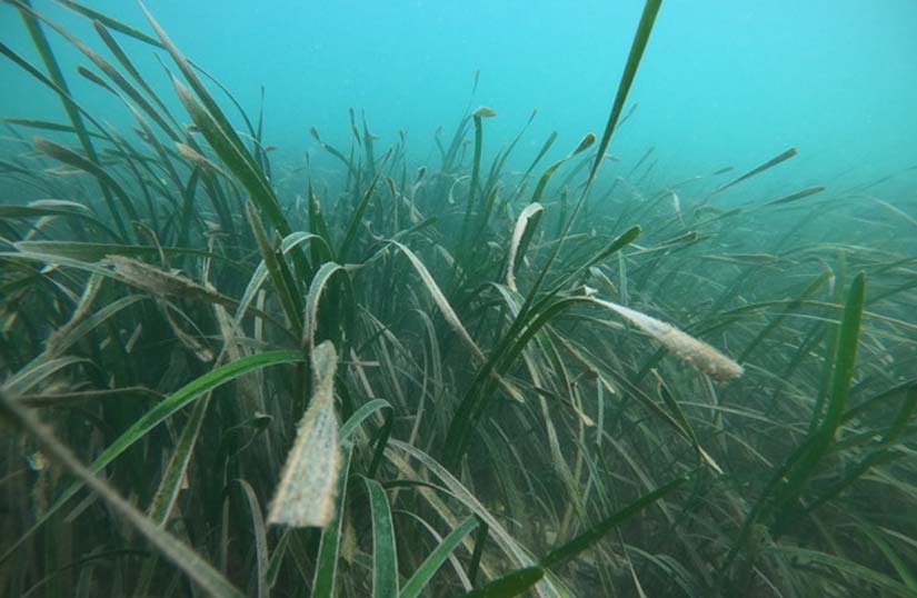
Water Sentinels
This is an educational project that empowers people from coastal communities to serve as citizen scientists for water quality, and detect historical and current pollution events. Its goal is the conservation and restoration of seagrass meadows in the Sado Estuary area (Portugal). The project engages relevant stakeholders in data collection, and a water quality workshop. A community guide for water quality assessment, a layman’s report and a video will be produced as tools to enhance engagement and participation of other community members on water quality assessment.
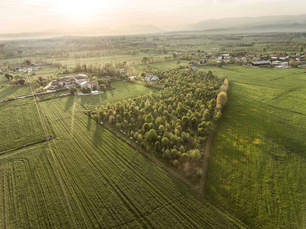
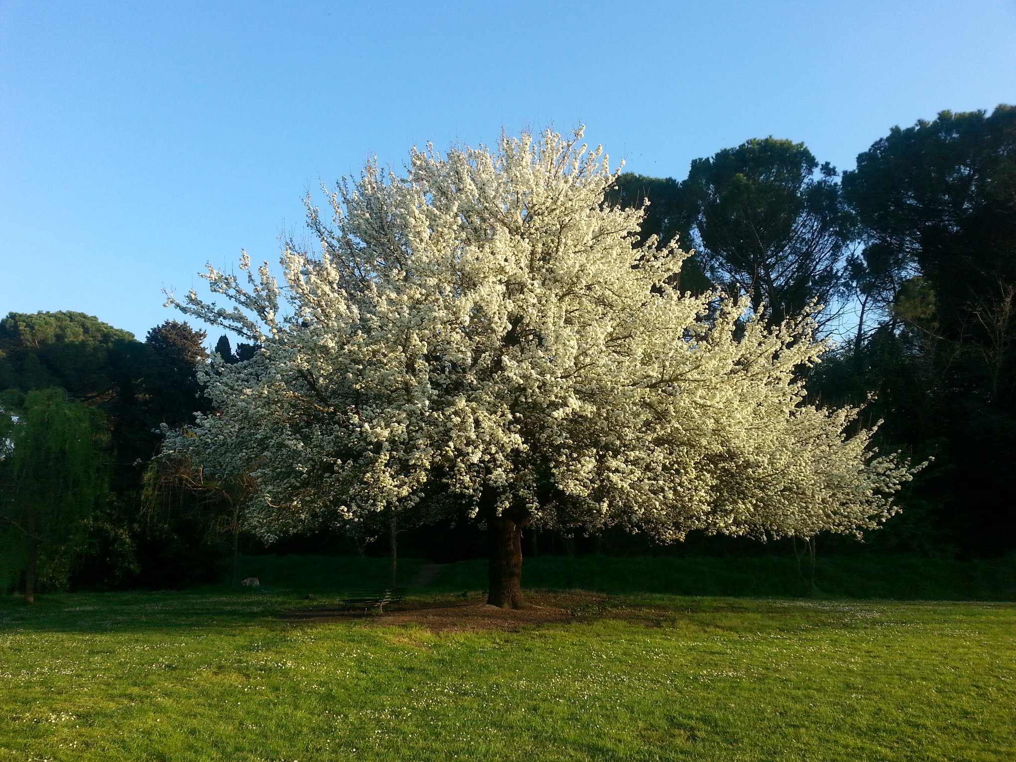
WOW Nature
This project is based in the Po Valley in Northern Italy, which has one of the worst air qualities in Europe. It uses trees to tackle this problem: studies all over the world are demonstrating the ability of trees in capturing pollution particles, but evidence is needed at the local level. The project aims to measure air pollution with innovative sensors within and outside urban forests in order to assess their efficacy as a mitigation measure for air pollution, facilitate their funding and educate and engage with citizens. Citizens will be involved throughout the project, participating in data collection and in co-developing solutions and policies proposals. Project activities will include education and dissemination activities as well.